Free property consultation

Property Consultation
Where's your property?
A platform-driven consultation over a virtual call. Pick your city — we'll connect you with the right expert.
Talk to an expert on a virtual call
Free property & risk consultation · book over WhatsApp, replies in minutes
WhatsApp Us
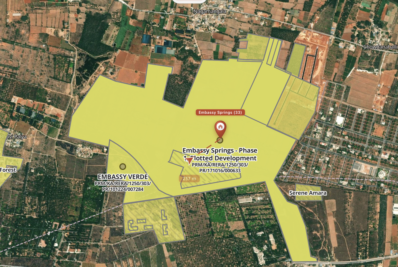
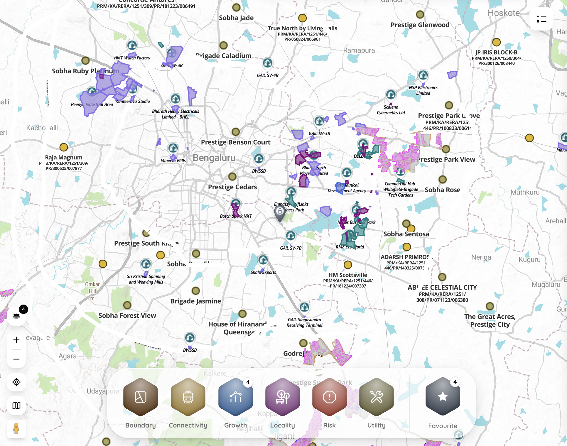
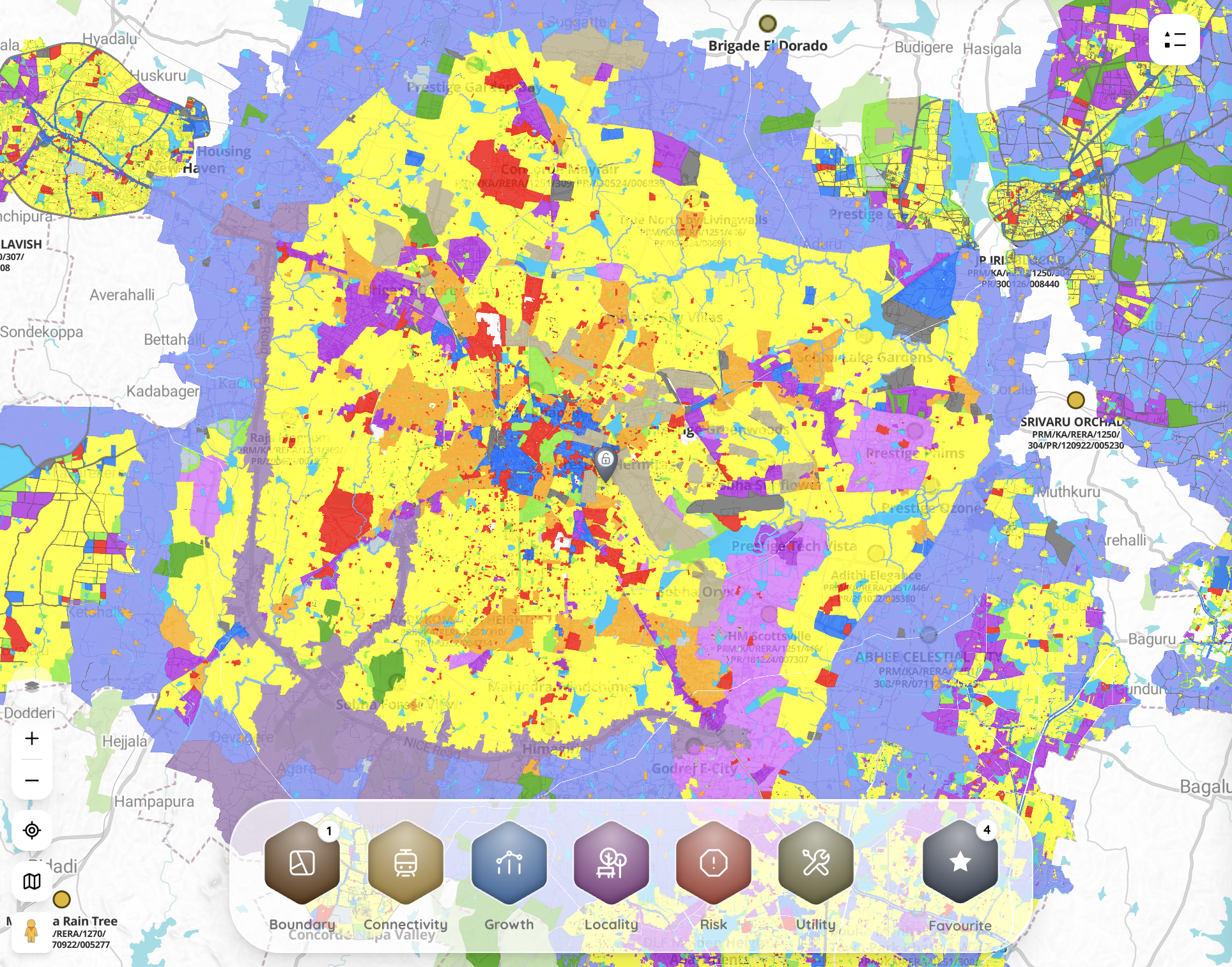
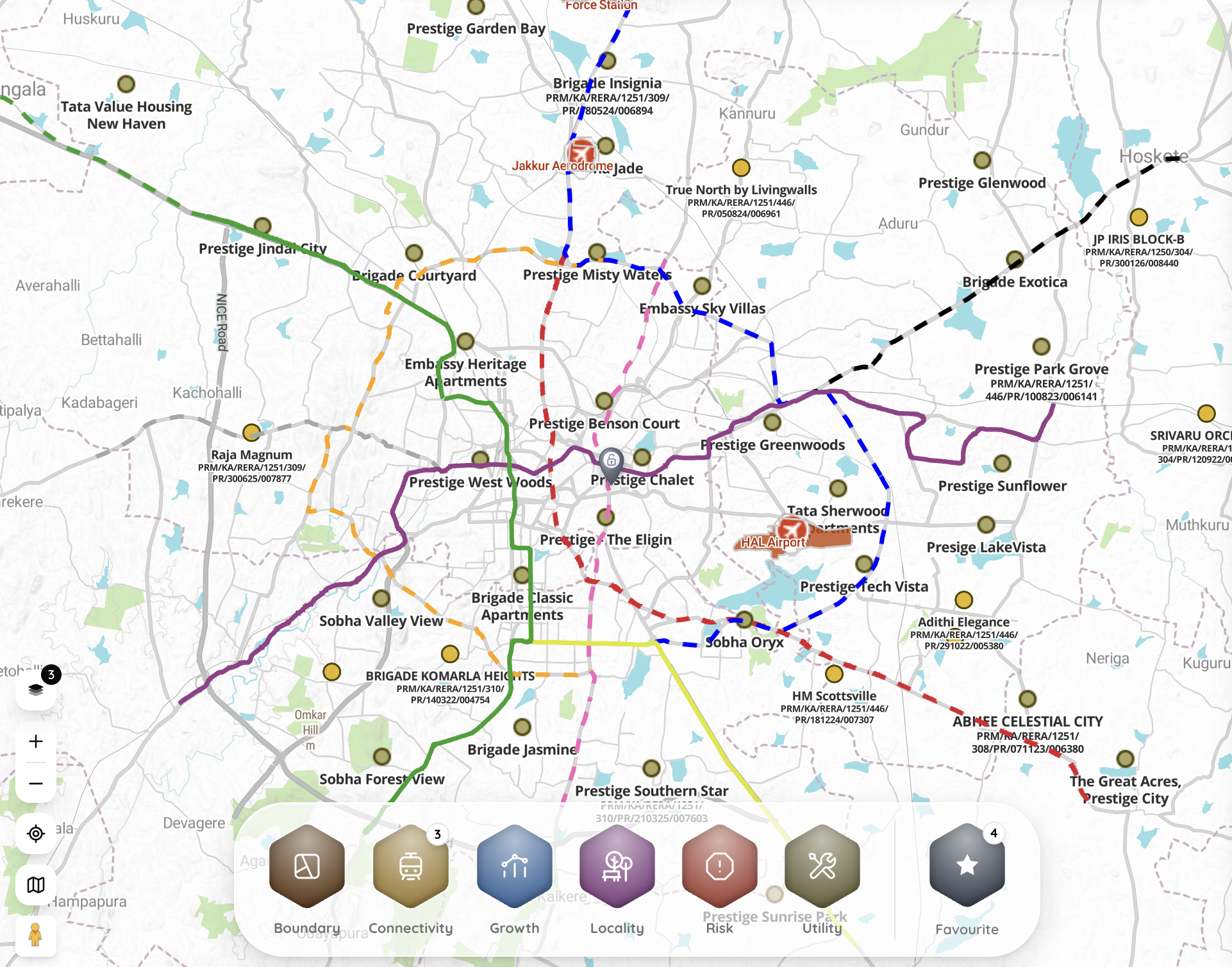
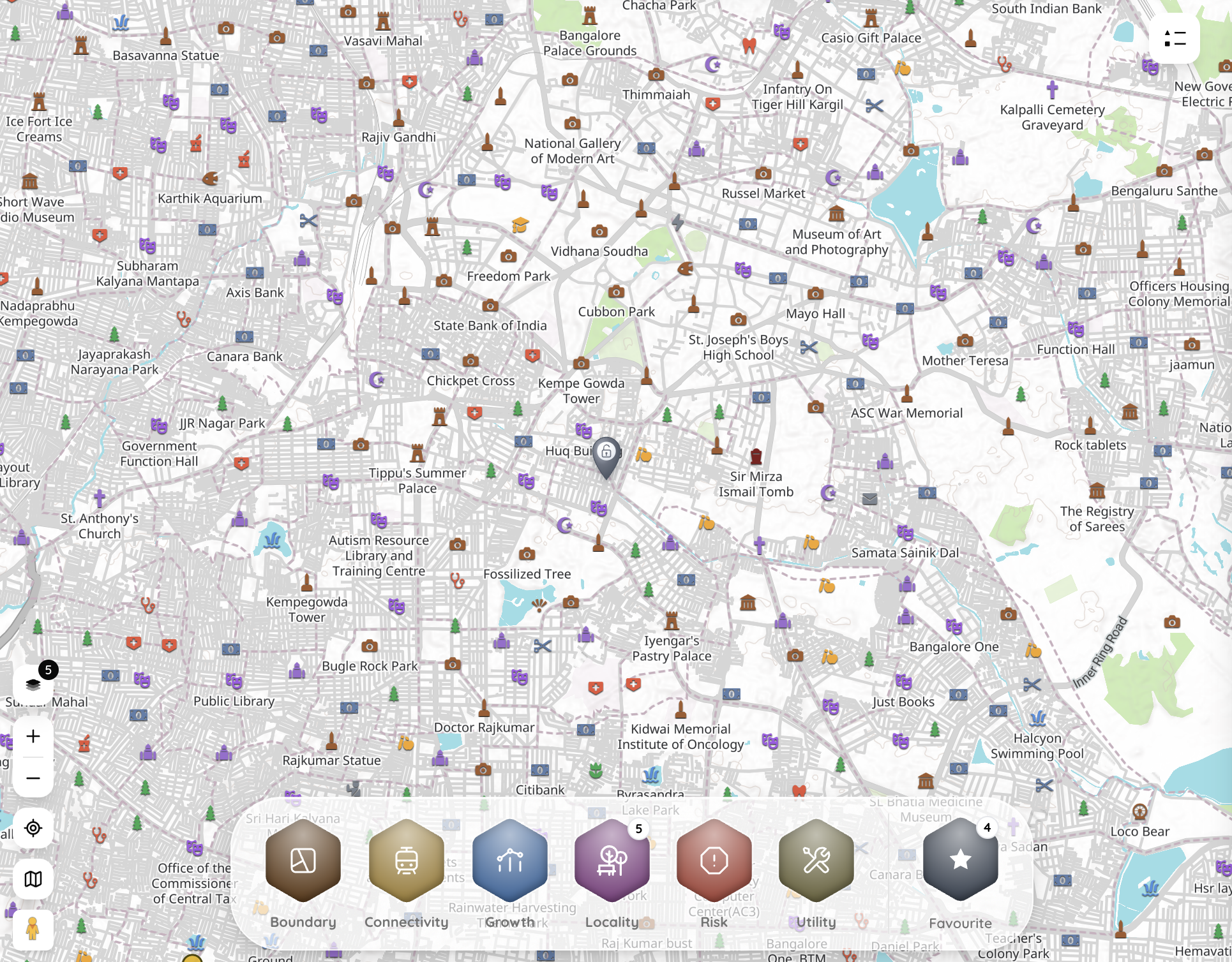
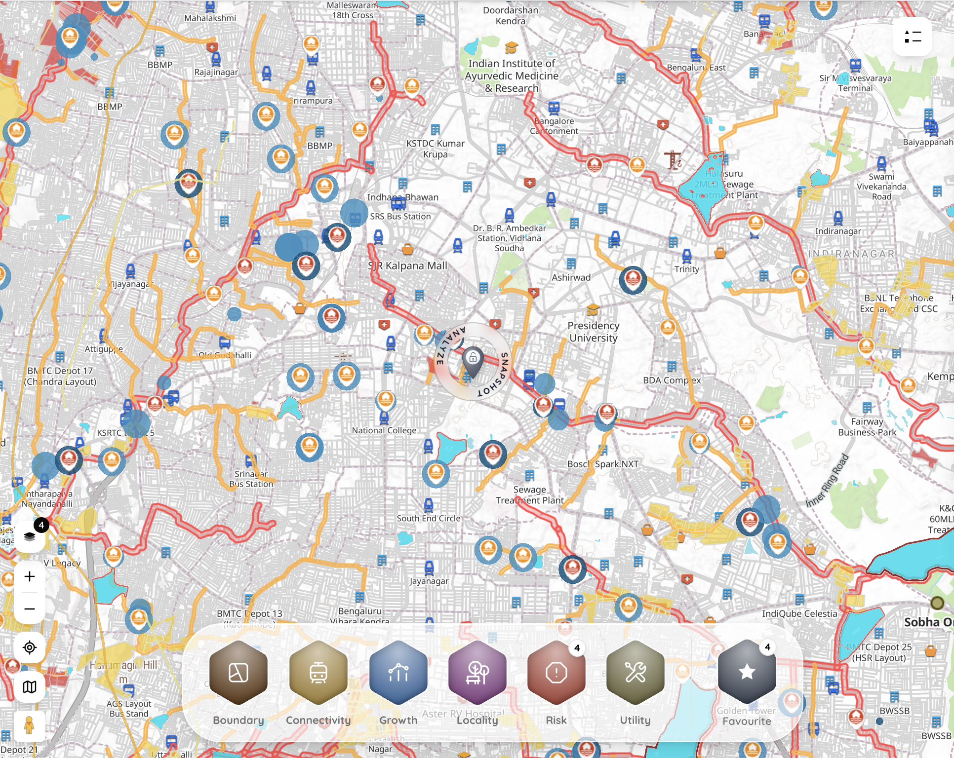
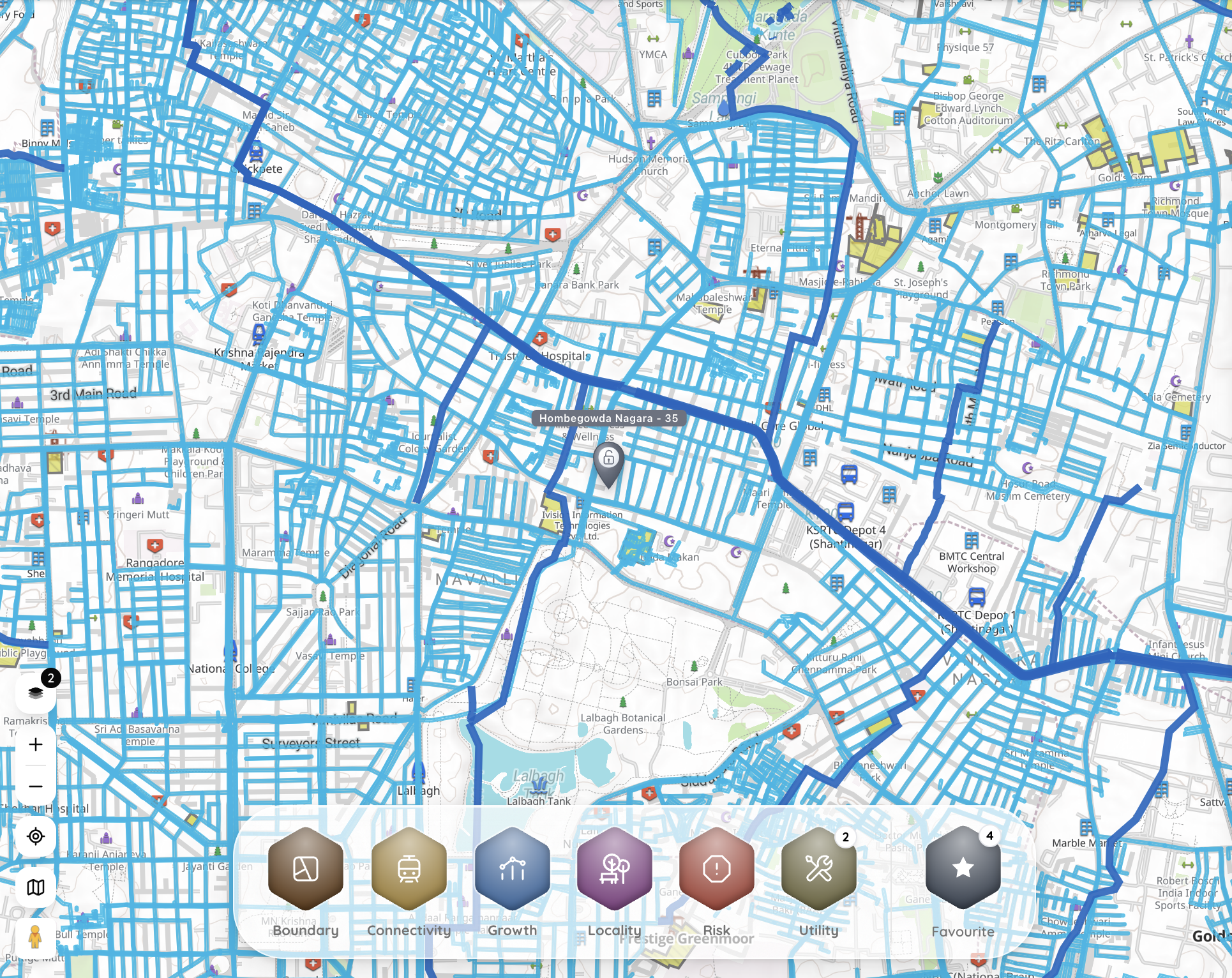
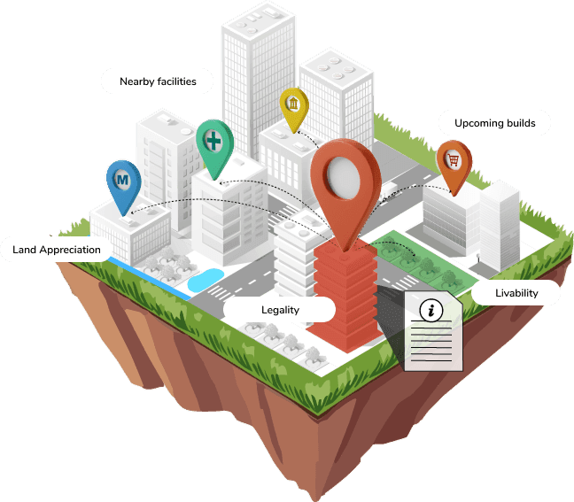
Risk
Growth
Upcoming infra
Connectivity
Locality
Select your city
Available in Bangalore
.png)